Conness GIS

12,590 ft

Create full GIS web apps, all from within a UI editor. No code required.

Open source, built on MapLibre. Settings for layers, widgets, and themes from a few JSON files.

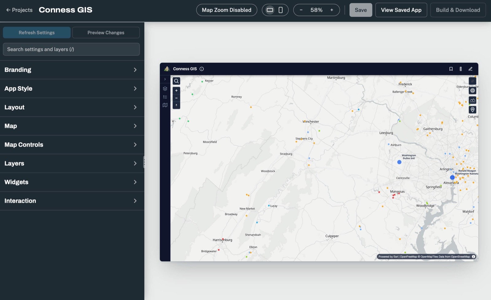
The Conness editor: settings groups on the left, a live preview of the map app on the right

Disclaimer

Conness GIS is provided "as is", without warranties or conditions of any kind, as set out in sections 7 and 8 of the Apache License 2.0. Its authors aren't liable for any damage that comes from using it.

Maps, data, measurements and search results shown in apps built with Conness GIS aren't guaranteed to be accurate, complete or current. Don't rely on them for navigation, emergencies, or legal, safety or property decisions.

Whoever builds and publishes an app is responsible for its data and for following the terms of the services it uses, like basemaps, tile servers and geocoders.
License & credits

Conness GIS is licensed under the Apache License 2.0. You can use, change and share it freely, commercially too, as long as you keep its copyright and license notices. The license includes a patent grant.

It's built on MapLibre GL JS, with basemaps from OpenFreeMap and map data © OpenStreetMap contributors, plus the open-source libraries listed in the Introduction. Each keeps its own license and attribution.

The projects and companies named on this site aren't affiliated with Conness GIS and don't endorse it.

Privacy

This site counts visits with Cloudflare Web Analytics, which sets no cookies and only reports totals, like page views, without tracking or profiling anyone. Cloudflare, which hosts the site, also keeps standard request logs.

The site's fonts load from Google Fonts, so your browser asks Google for them. There are no accounts, no forms and no cookies. Your light or dark mode choice in the docs is saved in your own browser only.

Conness GIS itself sends nothing about the apps you build with it, or their visitors, to anyone.

Trademark

The Conness GIS name belongs to Eric Samson. You're welcome to use the name to say an app is built with Conness GIS (every app credits it in its map credits, plus a line on its info page that can be turned off), but not in a way that suggests it's made, endorsed or supported by the project.

Conness GIS isn't affiliated with any company. It's named after Mount Conness in the Sierra Nevada.